Regional threats to Lake Huron’s biodiversity and water quality
According to the U.S. Army Corps of Engineers, which monitors Great Lakes water levels, is predicting that Lake Huron will reach an all-time high this June. The predict that Lakes Michigan and Huron will start 2020 at slightly over 6cm (11 inches) higher than water levels the same time last year (January/19).

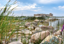
photos by Sandy Lindsay/Saugeen Times
“The latest forecast extends into March, and for the most part, levels are going to be on-par with or above where they were at the same time last year,” said Keith Kompoltowicz, chief of watershed hydrology at the U.S. Army Corps of Engineers in Detroit. “Lakes Michigan and Huron are an inch or less off their 100-year highs.”

Officials predict Lake Huron will read 177.58 centimetres in June, surpassing the previous record of 177.5 cm in October of 1986.
Over 1,000 structures sit in an erosion danger zone along the Ontario shores of Lake Huron. Of those, 700 are in Huron and Bruce counties.
While communities, including Goderich are attempting to stop rising water levels from decimating its beaches by shoring up with armour stone, according to the Lake Huron Coastal Conservation Centre (LHCCC), one of the best remedies is to allow beaches to create dunes through plantings.
According to the LHCCC Coastal Action Plan, “As coastal communities grow and change, focus is needed on maintaining ecosystem function, wildlife populations, adapting to climate change and maintaining water quality. This will require environmental restoration, protection, and enhancement to ensure the vitality of these ecosystems, and the surrounding communities. Significant regional threats to Lake Huron’s biodiversity and water quality, including pollution, shoreline development and alteration, invasive species, and climate change create risks to the health of coastal ecosystems … From removing hardened shoreline structures on private property, to embarking on reforestation projects; collaboration, communication, and proactive planning are the tools that will allow us to become resilient and sustainable, together.”
Frank Burrows, Saugeen Shores Manager of Parks, recently spoke to the Saugeen Shores Men’s Probus Club and explained the process of beach ecology.
“Our waterfront is divided into zones and not all zones are handled the same,” said Burrows. “Each is dependent on usage and the integrity of the area. When it comes to dunes, removing them will destroy a beach as the waterfront is ecologically complicated and fragile. While some people like beaches left natural and that provide habitat for wildlife, others want the beach groomed. It’s a real balancing act.”
He pointed out that Port Elgin Beach in particular suffered because of its lack of dunes and, as a result, is a very wet beach. Planting the right grasses help to retain the sand the would be lost through wind erosion. “With our recent rising water levels, we have to be especially cognizant of protecting our beaches by helping them to create dunes.”

Burrows said that during low water levels, vegetation begins to grow and, if removed with heavy equipment, it destroys the beach as the root systems are eliminated and they are what holds the sand. “Unfortunately, some people take matters into their own hands but the public lands should be respected. Sand has a cycle that provides sustainability. Wind creates sand migration and, again, dunes with grasses help prevent that. However, high water levels actually drag the sand out creating sand bars. Most beaches were created during the ice age so, once sand is lost, it never comes back.”
He also explained that each beach is different. “Southampton with its dunes is very different than the wet Port Elgin beach that has been heavily groomed. Kincardine is doing very well with its beach conservation by leaving some dunes.”

“Along the multi-use trail along the shoreline, we have had to shore it up with stone but even that doesn’t stop the erosion,” said Burrows. “In Southampton, Captain Spence Trail has been almost entirely lost.”
He added that a lot of run-off in the spring can result in trees and logs, particularly north of the Saugeen River, being washed up on shore. “While some people don’t like it, it is actually a measure of protection against erosion and also provides habitat for wildlife. Also, along the beaches, often there will be what appears as black sludge. All it is, in reality, is vegetation that washes up on shore and it is filled with nutrients. We try to keep on top of it with manually raking but it is a part of nature.”
Burrows, with an Honours Bachelor os Cient in Biology and Master of Science in Forestry, was a Park Ecologist with Parks Canada and, prior coming to Saugeen Shores, was Superintendent of Bruce Peninsula and Fathom Five Marine National Parks on the Bruce Peninsula. Today, in Saugeen Shores, he leads a team of staff that cares for over 40km of trails, 36 passive parks, ball diamonds, soccer pitches, 18km of waterfront and the town’s green spaces that include over 200 gardens. In addition, his team manages the Port Elgin and Southampton Harbours and Tourist Camps and has managed projects such as the ash tree removal for the Fairy Lake Restoration, the Port Elgin waterfront promenade expansion, Coulter Parkette and Waterfront Stewardship Program.


